Portable BGAN offered by Inmarsat, the world’s leading provider of portable satellite internet and voice solutions, is the only mobile satellite service to offer simultaneous broadband data and voice through a single, extremely portable device. BGAN Satellite is also the first service to offer “guaranteed” data rates on demand – up to 256kbps – for live video streaming and video conferencing.
RigStat LP, the Texas based company started in 2004, makes systems that are the “eyes and ears” for oil rigs and terminals, monitoring them even when they are unmanned during hurricanes. RigStat has conduced most of its business to date in the Gulf of Mexico, using Inmarsat portable BGAN Service to provide an always-on connection for some of its installations, sending data every hour over the Inmarsat network. As its reputation grows, it is finding customers in South America, Australia and other regions.
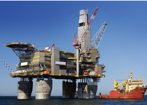
RigStat Pro’s patented system collects data from a variety of sensors on submersible, semi-submersible, jack-up rigs and oil terminals. Technicians on shore regularly receive data transmitted via the on-shore web portals from the systems, using the data to monitor the status of the assets. Although the system was designed to monitor the assets during inclement weather, it has practical application for year-round operation in normal conditions, such as checking the rig’s location in relation to nearby vessels and other platforms.
First deployed in the Gulf of Mexico in 2005 during Hurricanes Katrina and Rita – two of the most destructive weather events ever – the system proved its worth giving an almost real-time view of the location, wind speed and motion of a rig which had broken free of its moorings. After that, word began to spread within the oil business.
RigStat is a pioneer system in offering this level of detailed monitoring from unmanned platforms during extreme weather. Why is that important? It’s standard safety practice for oil companies to evacuate their rigs as a hurricane approaches, first switching off all systems and main power supplies and taking a GPS fix of the rig. However, sometimes this is not enough.
As one company learned the hard way, it costs a lot of money to retrieve, repair and re-moor a storm dragged oil rig. After Hurricane Andrew in 2004, one company flew over the last known location of its rig and found that it had gone. It took the company more than a day to locate the rig some 70 miles from its former location and then about a week to tow it back into position.
Any system that can significantly minimize these costs by communicating precise, virtually real-time status and location of a rig during and after a hurricane is highly valuable to energy companies. It might even prevent damage from happening in the first place. It will certainly help company personnel in deploying equipment and manpower after the storm in order to progress with remedial work as quickly and cost effectively as possible.

